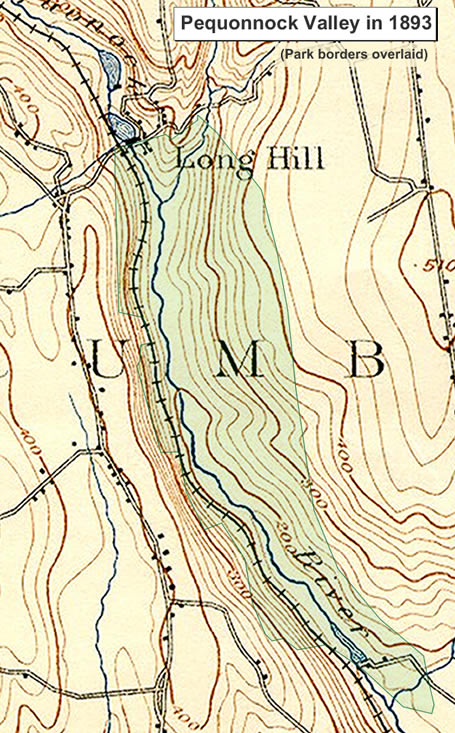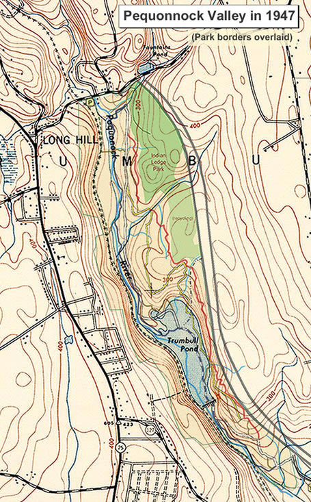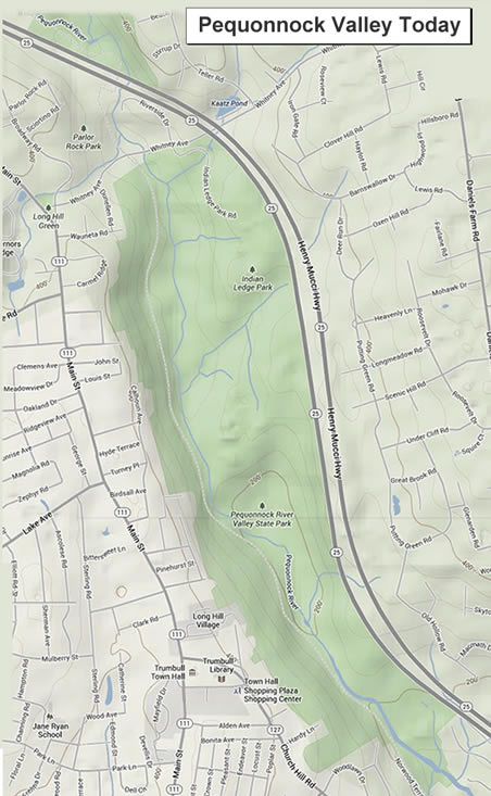
Pequonnock Valley - Historical Map Comparisons
Trumbull, Connecticut
Use the scrollbar to view a chronological map display of the Valley through the years...
About the map: These maps were created from the UNH collection and the 1867 map was culled from a uConn collection.
For Further Historical Info >