Historical Photos - Stations
Once the interactive map on the right is loaded, click on any station label on the map below to view details and photos.
Links to Historical Station Photos:
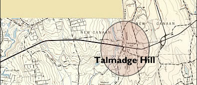
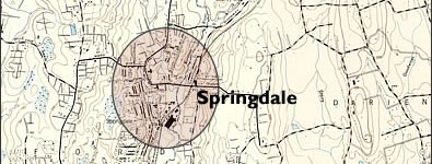
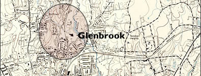
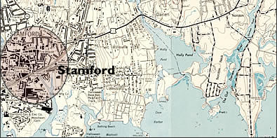
Stamford | Glenbrook | Springdale | Woodway | Talmadge
Hill | New Canaan
The links above will take you to a new window/tab
-use back link to return-
Historical Maps
- Cick to view the 1947 USGS Topo map at 100% view (1MB) progressive jpg
Note - Partially Double Tracked - Cick to full the 1899 USGS Topo map at 100% view (616K)
progressive jpg
Note - Single Tracked
Further Info
Be sure to visit TylerCityStation ![]() for an incredible amount of detailed well-researched historical info on these stations. Official track plans and diagrams, photos from every era and lots of additional historical info are nicely chronologically organized. Pick a station from the alphabetical drop-down menu.
for an incredible amount of detailed well-researched historical info on these stations. Official track plans and diagrams, photos from every era and lots of additional historical info are nicely chronologically organized. Pick a station from the alphabetical drop-down menu.
 |
 |
 |
 |
 |


