Interactive Maps
Trails, Railroads, etc.
Various Interactive maps
Trail Maps
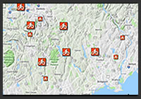
Fairfield County Ride Guide
Detailed Trail Maps of mountain biking trails systems in Fairfield County, Connecticut.

Mountain Biking Trail Maps
Assorted Trail Maps of a mountain biking spots in the northeast.
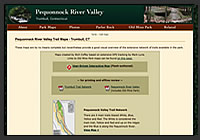
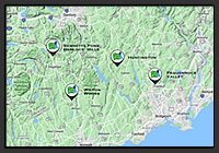
The Pequonnock Valley
This site features a large array of maps detailing trails, historical resources, and natural and geological info of a scenic State Park in Connecticut. Historical timelines, Google Earth Flyovers and aerial photographs reveal an enormous amount of detail about this picturesque valley.
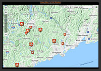
Trail Maps - GPS Visualizer
Features a collection of customized Google Maps detailing mountain biking trails systems in Fairfield County, Connecticut. User-driven zoom and layering opacity options, clickable icons for directions, etc/p>
Railroad Maps
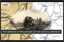
The Growth of Railroads in the Capital District
Chronological details on the growth of railroading in New York State’s Capital District told primarily through maps.

Northeast U.S. Interurbans
A 1924 Snapshot of the Northeast's (New England and New York) trolley systems. Interactive maps are the centerpiece of this endeavor.<
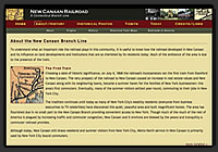
New Canaan Railroad
Website featuring historical maps. Town locations—when clicked—access historical photos and other details.
Historical Railroad Maps | Historical Photos - Stations

Historical Maps of Connecticut Railroads and Trolleys 1
A compilation of Connecticut historical railroad and trolley maps. Thumbnail navigation provides easy visual access to a variety of online maps and historical info
Miscellaneous Maps
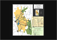
Historical Map Comparisons
Historical Map Comparisons of selected mountain biking parks in Southwestern Connecticut. View 1893 Topo Maps with more recent overlays, etc.
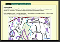
Landscape and Soil Maps 1
Glacial History, Environmental Studies, Soil and Forest Assessments, etc.
Mianus River Park | Pequonnock Valley
 Flash-Authored Maps
Flash-authored interactive trail maps featuring visual details of single track mountain biking trails in various popular southwestern Connecticut State Parks
Early Work with Flash...
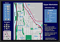
Northern Manhattan
Fully Interactive Map of Northern Manhattan utilizing layering, navigable zooming and more...
New York City
Flash-based Interactive Map demonstrating layering
1 - Note: Collection was compiled, not authored by Rich Coffey
![]() < Return to Knowledge Tree Choices
< Return to Knowledge Tree Choices